

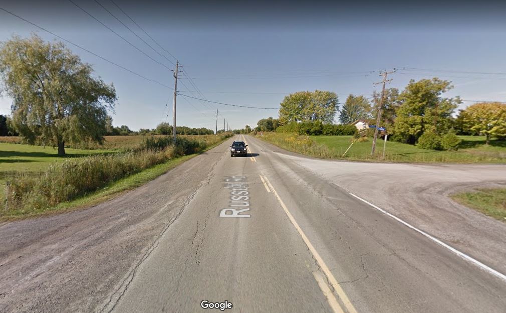
Ottawa is a large place. We have a photo of my wife’s father standing in front of a row of brand new houses. The trees behind him look about 5 years old at the most. He is four years old and the neighborhood is called Old Ottawa South. ‘Old’ was likely added later as there was no New Ottawa South. Ottawa stopped at Billings Brickyards, now Billings Bridge Mall; Altavista didn’t exist. We are talking about the mid 1920’s. The automobile was just 40 years old.
Amalgamation
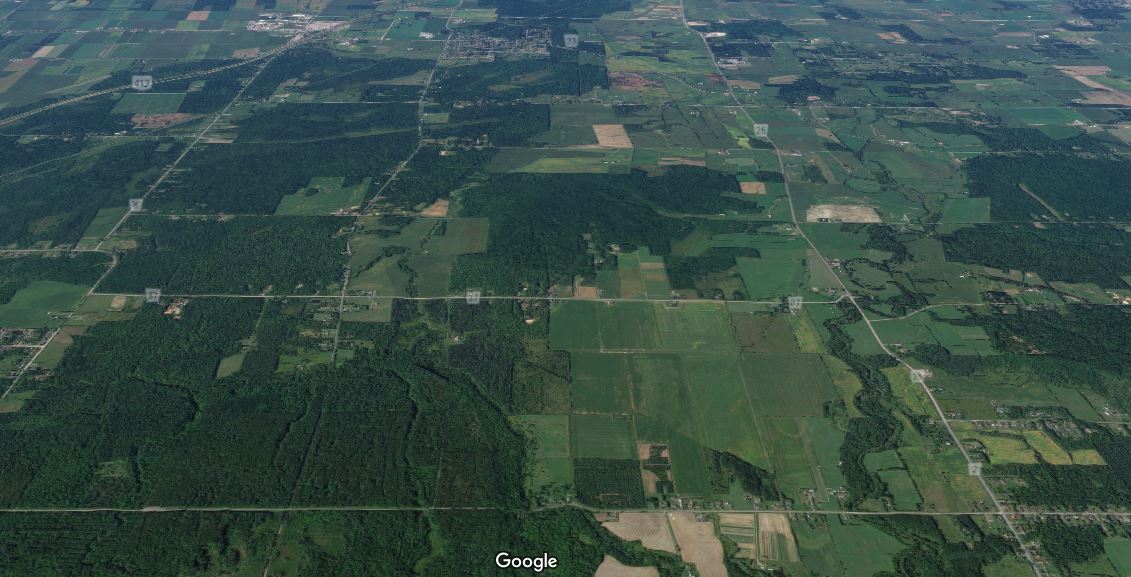
Through amalgamation Ottawa is now ridiculously large. Several small European countries fit together in Ottawa’s border. For the fun of it, I am showing two maps, with two routes (not all very pleasant) through our enormous ‘city’.


Below, I am comparing it with the Netherlands and Luxembourg. Cycling west-east in Ottawa is the equivalent of cycling from Amsterdam to Arnhem or cycling north – south through Luxembourg, give or take 10 km.


Ottawa Bike Commute
Recently, the census released ‘the journey to work’ data, as you can read in my previous post from last December. With so much rural land, it is somewhat unfair to say that Ottawa only has a 2.6% bike commute modal share. Therefore, Bike Ottawa president Heather Shearer (11,863 km bike kilometers last year) and I (2500 km last year, but I got more skiing in then Heather) sat down over coffee at the granite countertop at Heather’s suburban house just before Christmas and figured out a somewhat better way to compare. Let’s face it, we need to compare apples to apples.
Inside the Greenbelt
Without going into the administrative ownership of land in and around Ottawa (a nightmare for cycling advocacy is all I can tell you!), you have to know that once upon a time, the old city of Ottawa was a lot smaller. At some point in time NCC designed a greenbelt around the city and parts of other neighbouring cities, such as the ‘old’ part of Nepean. In the map below, I drew a rough outline of the area within the greenbelt, consisting of the old city of Ottawa and its older mostly 1950’s to 1970’s suburbs, known as the inner suburbs in city speak. The entire city of Vancouver fits inside Ottawa’s greenbelt.

For another visualisation of how big Ottawa is, Heather and I are adding this #ottcity Tweet:

If you live within the greenbelt, you can fairly easily cycle to a number of job hubs, such as hospitals, the downtown government buildings and educational institutions. The area inside the greenbelt is about 20 km at its widest point so that makes it a bit more comparable with a city like say, Rotterdam in the Netherlands.

I should note here, as you can see below, that bike commutes generally are less than 8 km, or 30 minutes, similar to the Netherlands and likely anywhere else in the world. In Ottawa, over two-thirds of all bike trips are shorter than 4 km, and over 90% are shorter than 8 km. Hey, we’re not much different from the Dutch after all! (*waves Dutch passport*)

Cycling mode shares in Ottawa
On censusmapper.ca Heather and I manually chose the census tracts within the Ottawa greenbelt, all 102 of them, and we were able to pull down all the cycling related data. And guess what: all of a sudden the commute modal share for Ottawa nearly doubled, to almost 5%, with a median of 3.85%. That sounds a lot better than 2.6% already. Predictable areas such as the Glebe, Old Ottawa South and Civic Hospital are areas with the highest number cycle commuters.

In the Ottawa Bicycle Plan of 2013 cycling mode share targets for 2031 for the inner area and inner suburban area (ie inside the greenbelt) are set at 12% and 6% of internal trips respectively. In 2016, six Census Tracts in Ottawa already reached that 12% goal and 25 Census Tracts have bike commute modal shares between 6% and 12% already. Note this table shows internal trips: Heather and I cycling from the inner suburbs to the inner area doesn’t count. If our friend Alex cycles from the inner area to Kanata in the early morning to fix the effects of a security leak in some processor, that doesn’t count either. But considering the fact that so many trips are less than 8 km, these are outliers.
More good news
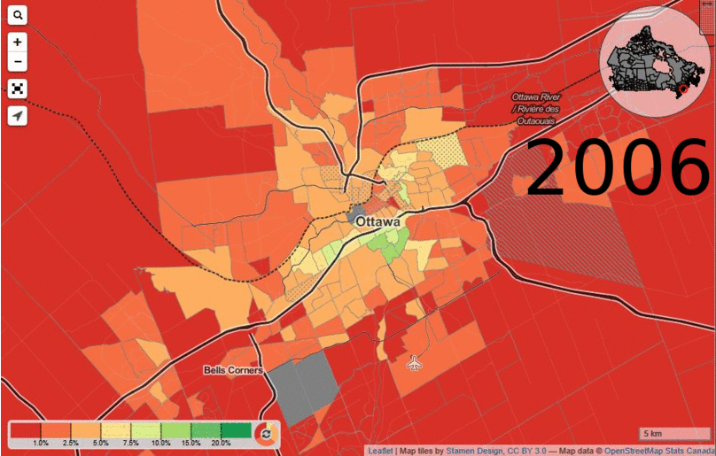
In 2006, the number of census tracts with a bike commute bike modal share of 7.5% or higher was 8. In 2011 that number increased to 14 and in 2016 no less than 20 Census Tracts had commute bike modal shares of 7.5% or higher. See the changes in the last 10 years below in this animated GIF.
Female – Male split
We also looked to the split between women and men. We found that of the commuter cyclists, 38% is female and 62% is male in Ottawa. This sounds like a fairly dramatic split but it is close to a 40/60 split and that isn’t bad at all. We only need a ten percent flip to be close to places like Germany and the Netherlands, where the split is around 50-50 according to this CityLab website. The site writes that modest research shows that women feel safer in places that are lit better and away from motorized traffic. As a comparison, in the city of London (UK) only 28% of the cyclists is female, in the Netherlands it is 55%. You can attribute street lights to that 55% if you want; I suspect it has more to do with the 35,000 km of safe bike infrastructure in the Netherlands.
Numbers
I am aware that numbers are just numbers, they don’t always tell the entire story. But it is good to see the numbers going up if we compare the same area over the years. The inner area of Ottawa is making good process, the outlaying areas not so much. But let’s not forget there is more than just commute cycling. Spend some time along the canal and you will see hordes of people cycling by after the rush hour is over. And don’t forget the weekends: in the weekend of May 27-28 2017 for example, 7300 bike movements were counted by the counter at Canal Ritz.
What is a Census Tract (CT):
Short definition: Area that is small and relatively stable. Census tracts usually have a population between 2,500 and 8,000 persons. They are located in census metropolitan areas and in census agglomerations that have a core population of 50,000 or more. (source: StatsCan)
We counted 102 Census Tracts with a total population of around 430,000 inside the Ottawa greenbelt, just under half the city’s population. An average Census Tract of these 102 inner greenbelt ones had 4207 residents, the median is 4069
We saved the census mapper map and you can find it here: Commute to Work by bike in Ottawa.
Tip: City Clocks had an interesting ranking here, with three Ottawa neighbourhoods in the Canada Top 15 list of cycling friendly hoods.
For further reading on commute data in Ottawa, read my previous post. And I welcome comments.
Where can I get one of those bikes such as shown in the first image?
This particular one is a Bullitt, which is a Danish brand by Larry vs Harry. I don’t think they are sold in Ottawa, but there is a Toronto store that sells them https://curbsidecycle.com/collections/larry-vs-harry?gad_source=1 This company sells many different cargo bikes in Montreal: https://velolifestyle.com/collections/cargo-bikes
Stouffville has become a hot spot for new housing developments thanks to its location minutes from Markham and its vibrant Main Street. Located on a lush ravine, 9th & Main Condos + Towns is a brand new condo and townhome project developed by the highly reputable Pemberton Group which promises to deliver two boutique condominium residences and a number of townhome residences which will feature larger living spaces. Pricing is expected to begin in the mid $400,000s for City Suites and from the $700,000s for the Larger Oversized Condominium Suite Collection.
http://stouffvillenewcondo.com/
How are the cycling options in Stouffville?
It is good and useful to have done that analysis, Hans and Heather. When looking at other cities, particularly in the USA, I notice their “city” often tends to be old core, surrounded by independent suburban and fringe cities. So of course, counting only the pre-1950 areas can get a high cycling count for a “city”. Whether trumpeted for reasons of boosterism or its fake news, I cannot tell. But it creates a credibility gap between the claims for ridership and the reality on the ground.