

Recently, we visited Quebec for a few days to enjoy some cycling and a bit of je ne sais quoi. We made a stop at Pointe des Cascades on our way to Montreal to cycle a stretch along the Canal de Soulanges. I won’t go into the history of the canal, other than that at some point in time it was part of the system to bypass rapids in the St. Lawrence river.
Where is the Canal de Soulanges?
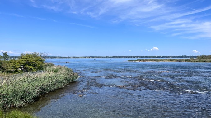
For reference, the canal is about 12 km due south of the Trans Canada Highway where it crosses the Lake of Two Mountains, the road bridge at Vaudreuil that most Ottawans take when we go to Montreal. The Canal de Soulanges replaced in 1899 the original Beauharnois Canal, until the upgraded Beauharnois Canal in turn replaced the Canal de Soulanges again in the early 1930’s. I had never really looked closely into that whole area, but it is quiet beautiful, with islands and waterfront galore. Unfortunately, the several power dams, closed for all traffic, make it hard to do nice cycling loops along the waterfront.

Pointe des Cascades
We parked the car (free!) in Pointe des Cascades at a small parking lot for about 75 cars. The lot was nearly full on that Labour Day morning. Given the bike racks on many cars, it appeared many were here for a bike ride too. We explored the nature park at the east end of the canal, enjoyed the vistas and the locks for a bit and were surprised that the locks were in such a terrible state of disrepair. Some locks are simply replaced by concrete walls! It made me realise how fortunate we are with our Rideau Canal in Ottawa, despite the limited and decreasing use by boaters.

Canals are an attraction
Back in 2008, I attended the international World Canals Conference on behalf of the Netherlands Embassy in Kingston. We brought in a Dutch speaker to talk about the Dutch canals and people were so excited about the canals that three years later the conference took place in Groningen in the Netherlands.
Coincidentally, the 2025 World Canals Conference takes place in Buffalo, NY on the 200th anniversary of the Erie Canal this week. I am really happy that people bother to keep the canal legacy alive, from China to the Netherlands to Canada.

Interpretation panels along the Canal de Soulanges
After exploring the east entrance of the canal, we set out cycling part of the canal trail westbound. At the start we found interesting interpretation panels with historic images and stories, diving deeper into how the canal was built. Along the way you can scan QR codes and listen to stories on your phone, but I didn’t see anybody doing that though.

We passed another set of locks which are mostly hidden behind bushes and fences, but there is a well trodden path past the fence, so I walked along the edge of the canal on a wall to see the locks. A bit further west, we had proper access as you can see on the image below.

The pathway itself is in a very good state, with picnic tables and benches in several locations and mostly smooth pavement. We saw many people cycling here, a constant stream of people, from folks on e-bikes to the Lycra clad and parents with kids. There are several gazebos and even toilets.

Apple Orchard
Just west of the Locks nr 4, we passed a former apple orchard. It appeared not being in use anymore. We noticed hundreds of apples on the ground and the trees were clearly not maintained anymore. I guess it is cheaper to bring them in from Chile and New Zealand.
Les Cèdres
Between the locks and the apple orchard you can see Highway 30 running underneath the canal and a bit further, the toll booths for the highway. From there it’s another 2.6 km to the intersection with Chem. Saint-Féréol, where a sign indicates a crèmerie down the road into Les Cèdres.

While we didn’t feel like ice cream, we did want to check out the route into the village. It is initially a multi use pathway a few meters away from the road, but then it turns into a bidirectional bike lane, built on a shoulder. It looks like the narrow-ish bridge across the creek (probably more like a culvert) wasn’t an issue. It appears they recently simply pushed the guardrail out a bit by a foot or two to make room for the bike lanes.
Connection with village
A new elementary school was built somewhere in 2024/2025 on the east side of the road, and with that came a short new stretch of multi use Pathway, and a new bike and walk link into the neighbourhood behind the school. This greatly improves accessibility to the school and the pathway along the canal away from the road. The maximum speed on the road next to the bike lane is 50 km per hour.

Little money, safer link to Canal de Soulanges
I thought it was interesting to see how, with little money, all of a sudden a safer link between the canal, the school and the village was established. Yes, it is only paint and flexiposts a short part of the way but it is also about the thought that is put in and the willingness to put it in. Combined with a slower speed, I think it is a good solution for now.
As we had to move on to Montreal that day, we turned around at Les Cèdres and biked back the same way. Halfway, Karen was asked to take a photo of a young mother and her son at the former apple orchard. They were both on their bikes, and I took the opportunity to take a photo of a loaded apple tree. I think we put around 30 km in.

Don’t rely on social media alone for your cycling information
Traditional media in Ottawa rarely report on cycling anymore. But there is a lot happening. Safer infrastructure is being built, advocacy events are being organised. Sign up for free for new posts if you want to know what is happening, delivered right into your inbox. Because it is so easy to end up in a negative echo chamber without getting updates on what is going on.

Recent posts by Hans on the Bike
- Cycling along the Canal de SoulangesReading Time: 5 minutes The Canal de Soulanges, just west of Montreal, was once an important waterway. Now the path along it attracts many cyclists.
- Ottawa increases score once again in ratings by People for Bikes
 Reading Time: 4 minutesYesterday afternoon People for Bikes, an American organisation for cycling advocacy, released the city ratings for 2025. Did Ottawa – Gatineau improve once again?
 - Should Ottawa – Gatineau try a bike share again?
 Reading Time: 6 minutes We have had a bike share before in Ottawa. With LRT expanding, it might be time to look at it again. If we Quebec City can do it, we should be able too.
 - How Strong Towns Ottawa got their Bank Street data
 Reading Time: 6 minutesIt is not always easy to get data from the City of Ottawa. Strong Towns Ottawa had to go through a city councillor’s office to receive the data they wanted to see. And then they got a 2500+ pages PDF with raw data of a Bank Street on line survey.
 - You can now see the ‘Fietsberaad’ website in Canada
 Reading Time: 2 minutesFor the longest time we were not able to access two important Dutch cycling websites, but this has now changed. And you can sign up for their newsletter.
 - November 7: opening new bike lanes with Ariel Troster
 Reading Time: 3 minutesThursday November 7 at 11 am, ride with councillor Troster in Ottawa
Discover more from Hans on the Bike - Cycling in Ottawa and beyond
Subscribe to get the latest posts sent to your email.
Leave a Reply