

As COVID continues, we think that cycling (but we are biased) is one of the best things to do to stay active and social. We are not alone, as bikes and bike parts are in short supply this year, although that likely also has to do with the supply side from Asia.
Even though we are quite content with cycling in Ottawa, there came a point that we wanted to see something else, which meant we had to bike further. That poses a bit of a challenge as there are only so many kilometers we can physically cover in a day. I am a bit hesitant to load bikes in the car, but I really don’t see myself cycling a 100 km out. I did that when I was 16, but not anymore.

We have been exploring a few other places, and you read about a nice Cornwall urban loop a few weeks a go already. Earlier this year, we went to the St Lawrence River to check out part of the Waterfront Trail between Upper Canada Village and the outskirts of Cornwall.
Upper Canada Village Waterfront Trail
We parked at Upper Canada Village where there was ample parking space (the village was closed, but we admired several houses from outside the village). The Waterfront Trail runs somewhat through the north end of the village passing the maintenance quarters and then dips into a nature reserve via several bridges. We cycled it many years ago but I only remember the grass being 5 feet high and a porcupine walking ahead of us. (no flat tires).

Waterfront Trail passes through bird sanctuary
This time, we noticed the path is now paved. After a few kilometers already, you will cycle into the Upper Canada Bird Sanctuary. You’ll pass a number of bird houses and you can leave your bike at an open spot with picnic tables to go for a nature hike (bugs!) a bit further down the pathway.

As you can read in a previous blog about Cornwall, the area was inundated by raising the water level in the St Lawrence River in order to allow bigger ships to sail through the St Lawrence. You can learn more about this enormous undertaking at the Lost Villages museum closer to Cornwall. If you look on Google Maps, you can still see the sunken roads and what appears to be a railway line under the water surface.
Did you know you can live track vessels on the St Lawrence River? Here is a link.
Upper Canada Bird Sanctuary

The Upper Canada Migratory Bird Sanctuary was established in 1961 on lands acquired by the St. Lawrence Parks Commission after the construction of the St. Lawrence Seaway. The sanctuary covers 9,000 hectares of a variety of wildlife habitats, including: a mature upland forest, early successional woods, old fields, wetlands and open water. With more than 8 kilometers of self-guided nature trails winding through these habitats, the seasoned birder and amateur naturalist, alike, have excellent opportunities to view up to 200 waterfowl, raptor, passerine and other bird species. Source: St Lawrence Parks
Long Sault Parkway
After about 10.5 km, you can turn onto a very quiet parkway that connects 11 hilltop islands, which were formed when the land was flooded in the 1950’s. The Long Sault Parkway is 11 km long and loops back to the mainland. The islands have several campgrounds, a beach and places to fish.

Most of it was closed in 2020 due to COVID, but there were still some spots to stop and enjoy the waterfront. The parkway is run by the St. Lawrence Park Commission. Although there is no bicycle infrastructure, other than a narrow shoulder, the traffic is calm and drivers go around you, giving you enough space. No one appears to be in a hurry as it is mostly a recreational destination. It is quite popular with cyclists: people driving there are used to people who like to bike on a calm road.
Canoe and Kayak along the Waterfront Trail
If you want to cool off, Mille Roches Island on the Long Sault Parkway has a beach with a canoe and kayak rental service: “Mike and Jenny’s Paddle Fit“. Great reviews, on Google, but I couldn’t access their Facebook page nor was the website super helpful (McAfee security warning). So the best thing to do is probably call them.
This might actually be a great addition to a trip out to the St. Lawrence. The water appears very calm usually, more “lake like”, if that is a word. The US border is very close, so be careful. Before you know you’ll be sitting in a jail in your swim gear for a month for illegally crossing the border. In fact my cellphone (Freedom plan) switched already to the US provider.
Ingleside

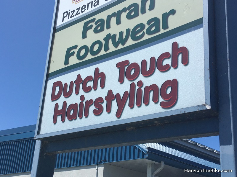
Just before the parkway you will see across from Highway 2 the small town of Ingleside, which was basically the place where people moved when their houses were demolished for the flooding of their land. It looks like one big 1950’s suburb with neatly raked gardens and annually sealed driveways. There is a bakery, a Foodland, a pizzeria and -wouldn’t you know- a ‘Dutch Touch Hairstyling’.
Lost Villages Museum
On the east end of the parkway is Long Sault, which also has a few places to stop for food. After the parkway connects back to the main land, you can continue to the aforementioned Lost Villages museum, that has moved a number of the historic homes to higher grounds. Soon after Long Sault you will pass Lakeview Heights, where you can find the Lost Villages museum. After Long Sault, the pathway continues to run close to Highway 2 which is called Vincent Massey Drive by now.

All pathways on the Waterfront Trail
The entire tour is on pathways, sometimes through green space, sometimes with views on the St. Lawrence. East of Long Sault you will be mostly cycling close to Highway 2, which is a little less pleasant in terms of noise, but it is all separated.

We turned around just before the Lost Villages Museum as we had to go back too. Count on about 55 km in and out. Alternatively, you could do it from Cornwall to Upper Canada Village. Depending where you start in Cornwall, add about an extra 15-20 km for a round trip though.
Strava route
Top 100 Cycling Blogs & Websites Every Bike Fan Must Read
In other news, I am also included now in the very comprehensive “Top 100 Cycling Blogs & Websites Every Bike Fan Must Read” on Feedspot.com. It is an interesting list of cycling blogs in one place.
Many are into the race & road cycling stuff, but there are a few gems in there too (like mine – 🤔). It is more than just an automatic content generator, blogs are reviewed and manually added by a team. If new posts are added you will see a notification. There is a free service and a paid service. Check out the cycling section here.
Leave a Reply