Last week, Karen and I were at a public information session for the reconstruction of Dynes Road off Prince of Wales Rd just north-west of Hog’s Back Falls. The road will be ripped up between summer 2017 and 2019, so the city brought the residents together to explain what the plan is.
Poof, slip lanes gone
There were drawings of the street on display with a cool new element, plus bike lanes and bike tracks. The slip lanes at Dynes and Prince of Wales are gone in the drawings, thus making the intersection a lot safer for everyone. The engineers and councillor Brockington lead the meeting, while councillor Egli from the neighbouring ward (west of Fisher) dropped by.

The engineers explained the sewer plans and the temporary nuisance that it will bring. There were rerouting plans presented and temporary one way measures. People were understanding. The engineers also mentioned that parking will be available on both sides of Prince of Wales near the Hellenic Centre (Greekfest) and that parking spots on Dynes will be reduced from 70 to 19. Gasping in the room.
Parking, not bike lanes, sets off emotions
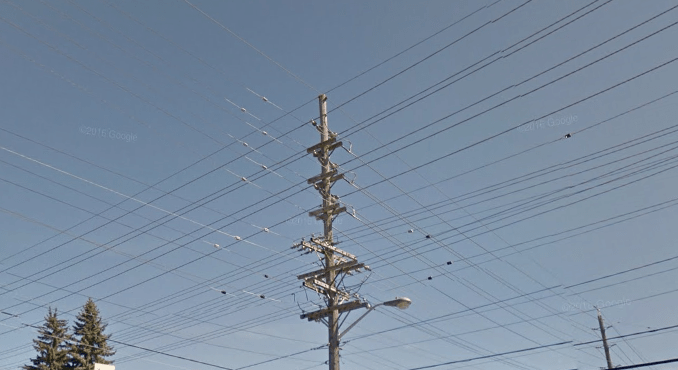
When the residents got their say, they weren’t falling over the bike lanes as I had expected. The first comment was about getting the hydro (not) in the ground. (For my European friends: hydro refers to electricity, not to water, even though lots of electricity is powered by nuclear power, not water.) Putting cables underground is not a city policy, but the city can make an exemption. Putting cables underground cost apparently at least $30,000 per home. I have strong suspicions that this is an amount chosen to put people off immediately. As one resident mentioned: it is a trunk line, not connecting to homes and the street is open anyway.

There were a lot of comments about speeding on Dynes. If the road could become narrower please, “but don’t have those centre flexi-posts, people pass them on the left“.
Parking
And then there finally was a comment about parking. And then another. Interestingly, people tend to feed off each other and more people expressed concern about parking. “The social housing residents park all their cars on Dynes, not on their property“. “Where are the visitors of the residents west of Claymore going to park?” Could the school provide extra parking?“. One person got visibly upset and asked the engineers “if they could share their parking data“? The engineers had their data from the fall of 2015: One afternoon, there was one car parked, another moment zero, another moment a couple of cars. The numbers were low, very low. Yet, a resident told the engineers they should go back because these were definitely not the right numbers. One woman piped in and wondered why we need bike lanes: “Nobody cycles here“.
Time for a counter opinion
Then Karen stood up and said that she believed that bike lanes were a good idea, that she cycles there to work and for errands and touring, that narrowing the street is good for everyone and will slow traffic down. Two others expressed worries about their kids walking to school and someone who doesn’t cycle but wanted to be constructive and mentioned that a bidirectional lane might be a good idea in order to have parking on the other side.
It is always interesting to see these evenings developing. Facts don’t matter usually, some residents get emotional, councillors promise residents to talk to city staff ‘if something can be done’ and engineers and staff patiently sit through the evening.
Some fact checking
After the meeting Karen and I decided to do some fact checking before we went home: we drove down Dynes to see how many cars were really parked that Thursday night at 8 pm. It was cold-ish, it was evening so most people should be home or perhaps visiting; no doubt there should be at least 30-40 cars, right?
We counted zero (!) parked cars along the entire length of Dynes.

The next day, we passed it again in the morning and we counted one car, in the afternoon we counted five cars. On Monday morning, I counted about ten cars when I cycled by, mostly in the area where the car spaces actually remain anyway. I am counting eight parked cars on Google Streetview in July 2016. On Streetview in June 2012, nine cars and a schoolbus. On Streetview in October 2012, I am counting only eight cars. On Good Friday, April 14, we biked Dynes for the entire length and counted four cars, all in the area where the 19 parking places are planned.
So yeah, bring on the street renewal.
Quick update: Heather Shearer did some math: “2.5% as many Strava users on Dynes vs. at Ottawa River Pathway counter. Translates to ~100 #ottbike trips on a summer day, easily outnumbering parked cars.” And that’s only the people cycling with Strava app running.
The second part of this story is here, where you can see the road designs and some of the suggestions we made (which have been ignored by the planner).
Here is what was presented at the meeting
Discover more from Hans on the Bike - Cycling in Ottawa and beyond
Subscribe to get the latest posts sent to your email.


“Facts don’t matter usually”. A sad truth in 2017!