

It apparently took 35 years, but the Nepean Trail is more or less finished: a continuous 11-12 km stretch through old Nepean, running south and north of the CN railway track.
Quote
The idea, borne by a member of the Trend Arlington Community Association, was endorsed by the Knoxdale Merivale Council (KMC) and later championed by the ward councillor.
UNQUOTE
Ask residents where the Nepean Trail starts and finishes and few people will likely be able to tell you. One maps shows it starts just north of Bruce Pit near Bell’s corner and ends at Baseline and Merivale (-ish), winding its way along Hunt Club and through hydro corridors, along residential roads and car dealerships.
Nepean doesn’t get much attention in the cycling news, but there is actually a lot of good cycling in there. The issue has always been that it isn’t always well connected and worse, the lack of wayfinding makes it really hard to figure out where you are going, especially in an area where everything looks awfully similar and landmarks are lacking.

Beachburg Subdivision
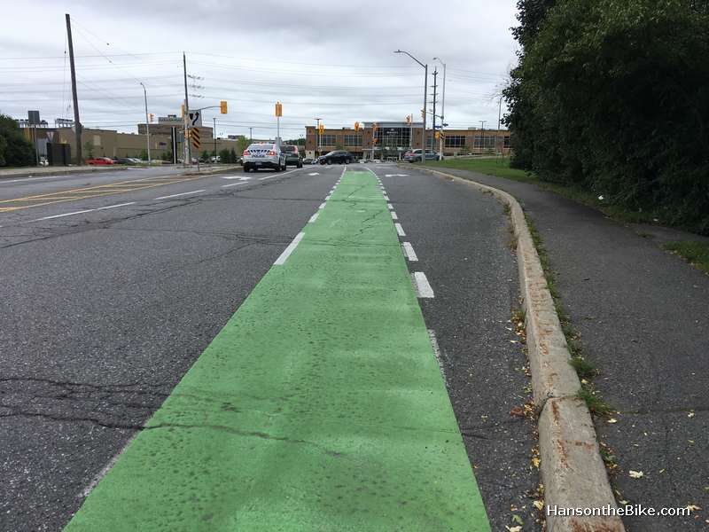
With one of the most important links now finished, we finally have a route that connects somewhat with the rest of Ottawa’s growing cycling network. This important link is a multi use pathway underneath the CN ANRR Beachburg Subdivision railway overpass on Merivale.
These tracks currently carry only Caprolactam via insulated tank cars from Arnprior’s Nylene Canada (owned by New Jersey based Polymeric Resources Corporation) and from what I heard, only twice a week. It is a serious barrier for communities on both sides of the tracks though. If only it could be used for commuter rail from west to east.


Oops, fiber cable
This underpass MUP was not easy to build as the city needed to dig into the berm that holds the Beachburg subdivision overpass. Once the backhoe started to dig, it turned out that the fiberglass cable was not buried as deep as it was supposed to (someone took a shortcut there) and work halted for a while.


Colonnade leads to a path across the Nepean Creek, but it is unfortunately not maintained.

Landscaping next year
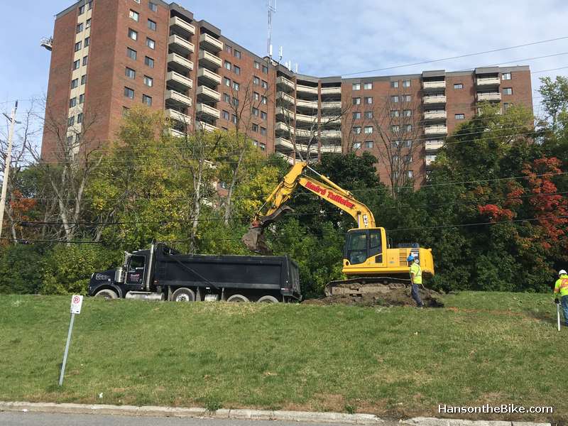
Work on the north east corner of Merivale and Colonnade wasn’t easy either as the city didn’t close a lane for workers to maneuver their machines on that corner. And then the snow came (and stayed) a lot earlier than has recently been the case and didn’t really go away anymore.
If you check out the intersection this winter, you will notice that the landscaping won’t be done anymore this year and the engineer overseeing the project (his first one for the city he confined to me) told me he hopes the snow covers the unfinished landscaping part for temporary better looks. You will also notice the green paint for the cross ride is not complete as they are waiting for a pothole to be filled first.

Nepean Trail Movati bypass
Another important link in the Nepean Trail finished in December was a stretch behind the east side malls on Merivale between Meadowlands and the Birchwood cul-de-sac, running behind places such as Movati and Emerald Plaza, providing much better access to the library. We used to cut through a small opening at the end of the cul-de-sac and cycle behind the malls on interconnected parking lots to Meadowlands and then continue on Grant Carman vv.


Avoiding Merivale
Good news: we can now cycle pretty much from the Bruce Pit in the far south west of Ward 9 to nearly the far north east of Ward 9 on lots of cycling infrastructure.
I have to admit that when I think of a ‘trail‘, I think of unpaved paths through enchanted forests, with fairies appearing from behind century old oak trees and not so much of a combination of roads and bike infra in a suburban setting behind 1960’s shopping malls, but hey, I am not complaining.
One part I am not entirely happy about is the location where the Nepean Trail southbound at Movati meets Meadowlands but I am hoping to work with the councillor to find a safer solution.

Baseline Rapid Transit Corridor
The northeast terminus is on Baseline. That sounds odd as Baseline is not a place you want to cycle, but that choice was made in anticipation of the raised bike tracks that are part of the Baseline Rapid Transport Corridor. This is years away from completion, but I understand they will start building this from east to west fairly soon. The environmental assessment is already completed. I am guessing that the first part will perhaps take another 5 years so in the meantime you want to connect to Fisher from Farlane via Sunnycrest or one of the Fisher Heights residential streets to go further north. Merivale north of Baseline is not a great option (and will see construction in the coming years too).
Wayfinding
I had asked councillor Egli if there would be a willingness to experiment with way-finding and that is being honoured. I am very happy with that as Ottawa is notorious for its hundreds of kilometers of pathways without any directional signs. Councillor Egli and his staff deserves a lot of credit for bringing this together with the limited financial resources for this trail.

Read more about the Nepean Trail here.
Sources:
https://unpublishedottawa.com/letter/502/great-news-cyclists-and-pedestrians-nepean
http://beachburg.blogspot.com/2018/11/cn-leaving-ottawa-look-at-possible.html
https://www.bloomberg.com/research/stocks/private/people.asp?privcapId=3175902
Thank you Hans. Very informative post. Loved the Pink Floyd reference.
Oh, and for dog walkers mostly…
Three times this past summer i started cycling east from Bruce Pits. Each time i got bewildered by loopy pathways around the pits, got advised by signs not to toboggan on the summer grass, and ended up on the loopy streets of Trend Village (trendy in the 60s maybe, but not ageing well). I was left with the impression the area was for car parking and six year olds to cycle with a parent for a few minutes, but the paths were not for anyone to actually go somewhere. I hope the signs and trail markers fix that by December 2019.