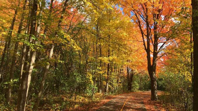
Mostly on multi use pathways, a wee bit of bike lane on a quiet road and a bit of residential road.
Last Friday, October 14, was a gorgeous day for cycling in Old Nepean: 14-15C (60F), blue skies and Fall colours. In fact, I find this weather is nicer to bike in than in the summer. No need for sun screen and no sweat, at least when you bike at my pace, around 16-20 kph.
This time, I cycled a route in Old Nepean, in the Merivale, Woodroffe, south of Baseline area. It just under 20 km and follows 85% multi use pathways: great for anyone.
I started at Fisher Heights but you can obviously start anywhere. If you come by car, you might want to consider parking at the Loblaws on Merivale and Baseline. If you come by transit a good place to start is at Baseline (soon Algonquin) Station.

I started by following the Nepean Trail south through the Fisher Heights neighbourhood along quiet residential roads, parallel to Merivale Rd. After crossing Meadowlands, I cycled in a bike lane on a fairly quiet road and after Viewmount, the route turns into a pathway soon.

Just before the Beechburg tracks, which kind of cut Old Nepean in half unfortunately, I crossed Merivale to connect with the pathways in Tanglewood.


Using the lights at Woodroffe, I continued further west to just before Greenbank, on a long path in a hydro corridor. But in order to get there, one needs to find a route from one pathway to another pathway, which is not posted (petpeeve!) unfortunately. Sherry Lane and Bertona are the streets to look for. There is a pathway through a park, but it is not always accessible as there is a school yard too.


At the end of the path near Greenbank, the route goes north through Shoreham Ave.
This gets you to Craig Henry Park, and more important to an underpass underneath the railway tracks. The pathway then continues to Centrepointe Theatre and the library. After this somewhat austere concrete and glass monolith, which used to serve as Nepean City Hall before the amalgamation too, the path continues along the (future) LRT line at Algonquin Station and crosses underneath Baseline.


I noticed that the path west of the LRT was open all the way to Iris, (actually it wasn’t once I hit Iris 😁) where you can cross the LRT line. During the construction a pathway just north of Baseline crossing the bus lanes is still open, but that won’t be for too long anymore I think. This path to Iris will be the future route to cross LRT on Iris. The Iris overpass has a very wide MUP.


After crossing LRT, I turned south again and cycled along the Pinecrest creek pathway until I hit Woodroffe again at the fire station, where I crossed on to the Experimental Farm pathway. On your right hand two large stormwater ponds have been dug, at great expense as it took several years. The retaining walls are something else.


Once at the top of Carlington Heights, you can go through a narrow opening in the fence to the water reservoir. Try to climb the water reservoir (it is a covered reservoir and open to the public): it allows for great views of Gatineau Park in the distance. I found my way back via Central Park, the parking lot of Walmart and eventually the parking lot of Loblaws, which is where you could start and finish your ride.

Here is a map in Komoot. I like Komoot as it also pulls off data from OpenStreetMap about the type of pavement and the type of road/path etc. It does say sometimes you have to push your bike, but I think that is an indexing issue. Komoot appears to read infrastructure indexed as ‘path’ as for foot traffic only.
for an overview of Ottawa cycling maps, go here.

Your excellent posts inspired this popular Kanata-Nepean Bicycle Club route. Thanks!
https://ridewithgps.com/routes/41277769#11.35/45.34424/-75.80793
Glad it was helpful. More to come this summer.