

2024 update: the pathway is closed. It should open again in the Fall. There is work being done near the Supreme Court. There is a cliff where some rock came down several years ago. This is being worked on. More here: https://ncc-ccn.gc.ca/projects/parliament-hill-escarpment-rehabilitation
Just before the first snow came down in the weekend of November 18-19 I thought I’d go for a bike ride to check out the repaired Ottawa River multi use pathway behind Parliament Hill and the Supreme Court.


Shoreline and pathway washed out
As you remember, the path was closed since the heavy rain in spring and had to be repaired over the course of another year as the Ottawa river had washed out parts of the pathway. It was supposed to be closed until spring 2018, but work progressed faster than expected and so the path re-opened already early November.
The fences didn’t stop about one hundred people to set up their garden chairs along the river to see the fireworks in the summer.


Earlier this fall at a lecture in Nepean, I learned there used to be Esso fuel storage tanks on Richmond Landing until about 50 years ago.

You can read a lot more on this area on the always well researched Urbsite.
Improved shore line
I don’t exactly remember how the path’s direct environment looked like before April 2017 though, but a quick look on Mapillary helped. There was not as much actual path gone as I had thought; it appears it was mostly the shore line that was destroyed. It looks like most of the work went into the reinforcement of the shoreline with rock. Lots of rock. And dirt. It stays level longer and than drops steeper towards the river.


Dangerous post
I cycled a bit further and noticed the staircase to Parliament Hill appears open. I didn’t see anyone running up the hill and I don’t think I am tempted much.
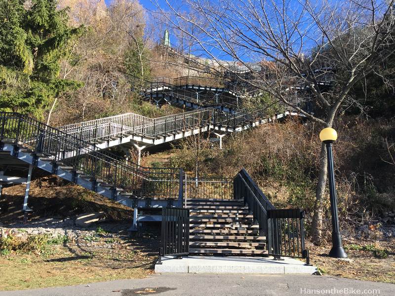
All that glitters is gold
And she’s buying a stairway to heaven”
There is massive work going on along the path at the bottom of the Supreme Court rock face for storm sewer upgrades. The path that connects one of the parking lots (yes, we park in prime waterfront spots in the heart of the nation’s capital) with the MUP along the river has been rerouted and now has a very dangerous dark post in the middle. I asked the NCC to take a look into it as this can cause serious harm, being dark, around a corner and without any warning. “We wish to inform you that the post is in place to stop vehicles from entering on the pathway. The Maintenance Manager will review the situation in order to find a safer and more visible alternative.”


Below I want to show you how a post should be properly introduced with reflective road markings and rumble strips. Since the NCC post will be there for another 1.5 years, it is worth making a proper adjustment.


That is it for this week.
Hans
Leave a Reply